
Spoiler alert!
 This Saturday we took a drive along the Agua Caliente Scenic Drive. It was 60 miles through the desert, and was definitely one of our better trips that we have taken. Plus we finally were able to take the Subaru to some of it's limits!
We started in the small town of Arlington, TX.. I mean Arizona... that's about an hour from home and 30 minutes off of the 85. We figured the scenic drive would take us back up to the I-10 around Tonopah, but we ended in Dateland right off the I-8.
The drive was gorgeous, but we had absolutely no idea where we were going. We didn't even see another car until about mile 40. The road was pretty well maintained by the Bureau of Land Management. The only issue was that there was a ton of loose rocks, so we couldn't drive very fast. It made the drive very slow. Plus we pulled off a couple times to try out the four wheel drive.


 In all of our research, we knew there were a few mines off the road, but we had no idea where they were. We pulled off to walk down a couple small roads that looked promising for mines. But boy were we wrong. We did, however, find some really interesting rock formations that I could crawl through.


Agua Caliente road lead us to the ghost town of Sundad, Arizona. Originally when we headed out, we were expecting a ghost town like Tombstone or one that has been turned into an attraction, but that was a little silly. Instead, we were met with a town that had been totaled All that remain were a few foundations, an old fireplace, and old sewage pit ad one standing basement.
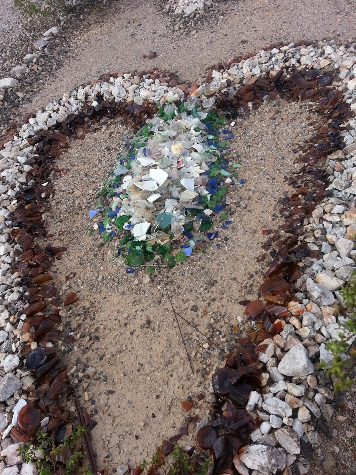 What was really neat about his place is that someone, I'm not sure who, took all of the trash that was left when settlers moved on, and turned it into artwork! When we came upon the road to Sundad, there was a giant triangle of rocks with the city name spelled out, that pointed the direction we were supposed to go. It also had an anchor and a star and a cross. Inside the city, piles of glass formed an eye, rusted tin formed a star, and several other designs.
 From the bottom of the city, we could see a huge building that had walls still standing. We went up to check it out, and finally saw the mines we were looking for! One was completely filled, but the other was not filled at all. The only preventative measure to keep people out was a wire fence. Not even barbed wire. We didn't go in though, because it was just a straight drop to the bottom. We threw a couple rocks in to see how far down it went, and I'm not quite sure we heard them land. I'm also pretty sure we heard the rock hit something soft of the way down..... could be my active imagination though.


There isn't much information of the city itself. On the way home I tried to google search the story behind Sundad, Arizona. I was met with nothing but rumors. The mines we came across are still in the county records though. Back in it's hay day, the settlers of Sundad mined Gold, copper and silver in the two little mines outside of the city.
 I also found a bottle with engraving in it, so I looked up the company that made the bottle. Apparently the company stopped branding their logo on the bottles in 1950, and was popular in the early 1940's, so that at least gave us a time frame of when this town was popular. There was also a ton of glass Clorox bottles. I guess they really did like their bleach. Makes sense when you work in a mine...
The only rumor we found on the city is that is was possibly used as a sanitarium after the mines went under. And it was most likely one for tuberculosis. We though it would be a pretty fun place to camp until we read that. Personally, I wouldn't find it fun to be haunted by tuberculosis patients...


Video 1
Video 2
Video 3
Sweet find, guys! Sounds like you had a mysterious adventure in the new Sub'. Beautiful pics!
ReplyDelete